“Not until we are lost do we begin to understand ourselves.”
Henry David Thoreau
Even with all the time’s I’ve been lost, I’m still not sure I understand myself yet. I do know that a really good day involves getting off the main roads and discovering a new location that I haven’t seen before. To me, finding a new white church steeple or a covered bridge surrounded by multi-hued sugar maples, birch or even oaks is the pinnacle of a great day.
Ok, when I talk about getting lost, I don’t mean to literally go out and get lost. You still should have a good idea of where you are. Yes, you should at the least know what state you are in and I don’t mean a state of confusion like me 🙂
What getting lost means to me…
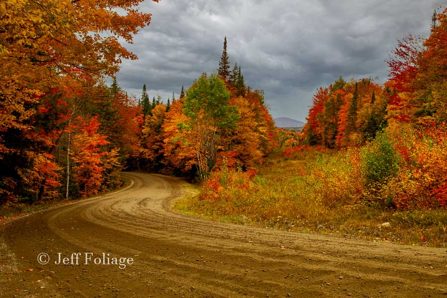
You should get off the main road (highways) and explore secondary or even dirt roads. If you’ve been reading my blog articles for any length of time, you’re probably tired of me yapping about getting off the highway and on to the dirt roads. Maybe you’re more at home on a quiet paved road? There is nothing wrong with that! I try to make note of winding roads through valleys and past hills covered in fall color.
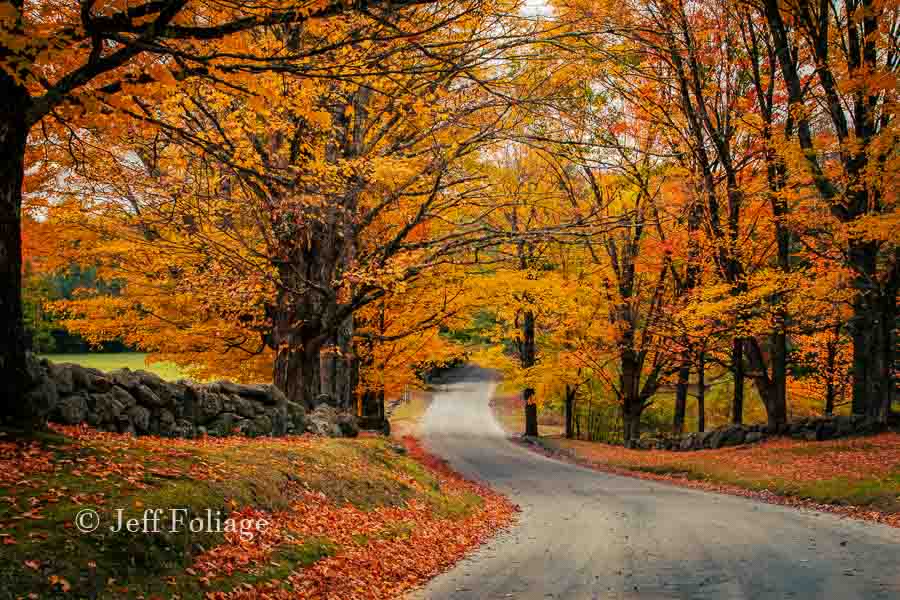
BUT! I do want you to get lost on these “backroads” and explore them with a good road map. I always suggest the gazetteers from Rand McNally which are my favorites. Next, I have a 2014 Rav4 with navigation and my mechanic says that this is a real GPS working off satellites many cars today are probably the same so you don’t need much more than this..
There are only two downsides. First, I have noticed that my car software doesn’t get regular updates, (Hello Toyota!!), so it’s got gaps. Second, if you want to get out of the car and hit a trail, you will have a hard time taking the car’s GPS with you.
Cell Phone versus Handheld GPS
Today’s modern cell phones are great as long as we have a cell signal. I have been in the boonies of Maine, New Hampshire, and Vermont and have not had a cell signal. So here is where you will need a “real” handheld GPS (yes they still sell them, click here to see one on Amazon) (this is an affiliate link).
I don’t usually get off on really rugged back trails too often but I do have a GPS on my phone like most of you, or do we…?
Most cell phones have mapping software (GPSish) that gets your position off cell towers. If no cell towers are in range (you are on the other side of that mountain), guess what? Your phone will be great for recording images of your trip but it won’t tell you where you are till you get near a town and maybe a cell tower.
Do you know what Vermont has damn few of, other than roadside billboards?… Cell Towers…
GPS Versus a Gazetteer
I travel with a “real” GPS, I have my cell phone for about 75% of my travels which is perfect but I also have my Gazetteers. You might be tempted to ask isn’t this redundant? Or even necessary? (the map and the GPS)?? Well, the reason I travel with both is quite simple. Planning versus location.
First, I have found that Gazetteers are great for planning where to go and what to see. You can see the terrain, rivers, and local items of interest like covered bridges. But If you find yourself on a dirt road in Maine with no street signs and you didn’t keep track of the turns, it’s tough to figure out where on the map you are. So unless you have a background in Orienteering and a serious compass then a map used by itself is lousy at telling you, where… you are.
A GPS, on the other hand, is wonderful for telling you where you are on the Gazetteer map but using your phone for locating all the neat landscape features around you is pretty difficult.
Map detailsGazetteers commonly include:
- » Back roads, dirt roads and trails
- » Elevation contours
- » Remote lakes and streams
- » Boat Ramps
- » Public lands for recreation
- » Land use/land cover – forests, wetlands, agriculture
- » Trailheads
- » Campgrounds
- » Prime hunting and fishing spots
And don’t forget they list almost all the covered bridges also!
Well if you want to see some of my scenic foliage routes follow this link and you can review the locations in your gazetteer if I caught a shot that you want to find then you can locate that image on your map book.
Finding Peak Fall Foliage
Are you ready to jump straight into Finding Peak Fall Foliage? Click that link and it doesn’t matter if you feel you are ready for that or not, sometimes you will find it, and others not so much. It is one of the biggest Cat and Mouse games that goes on each October in New England. Read the article for my tips that this article didn’t cover.
Finally…
If you have questions regarding this “Art of Getting Lost“, then drop a note below and I’ll post a reply as soon as I can. You can also visit my New England Fall Foliage page on Facebook. I’ll be posting updated pictures there this fall.
Jeff Foliage Folger
Autumn is a state of mind more than a time of year – Jeff Foliage
- Visit my Fine Art America Gallery
- Visit my Amazon store to pick up New England-related materials
- Visit my Pictorem Gallery (Free shipping in the US and Canada)
- My Facebook foliage page
- Threads.net/@Jeff_Foliage
- Follow our new Fall Foliage FB Group!
- You can visit Lisa’s Artist Facebook Page by clicking here
We love the Delorme’s too. Have one each for VT, ME and NH. I always like to see what’s over the next hill. They are especially handy for plotting a back road route to someplace, which for us is typically a plant nursery. Sometimes we get lost simply because I didn’t have good directions in the first place. One year found Horsford Nursery in Charlotte VT while looking for Pizza on Earth (check their website, most unusual pizza place).
We’ve stumbled on Ekhart’s Farm near Hillsborough NH.
We weren’t lost but finding Sandwich (NH) Creamery can be challenging and don’t be surprised to see a black bear cross the road.
On our last visit to the Harpswell Maine area, Ron noticed a nature preserve and asked a waitress about it. She said there wasn’t anything there. Exactly! A bit hard to find and a very bumpy road to a small beach area that most tourists probably never see. There was one small group enjoying the sun and water, a few fisherman and us! Great place to enjoy some quiet time looking at the water. People who complain about crowds just don’t know to drive back roads.
Harpswell Maine… hmmm. Nope I haven’t been there.. Maybe you have the map book page and where on the page to look? The really sounds like a perfect place to visit.
This is exactly what I mean when I say getting lost but not getting lost… You know where you are on the map but you are where others don’t go. It means that you are finding something few others will see in their lifetime and only the locals know about it.
Eccardt’s is a very neat place and I loved the museum he set up there. I didn’t get a chance to go to the farm store but it would have been neat to get some really fresh eggs… before hitting the road…
By GPS do you mean a separate device than a phone GPS (in case there is no service?)
The GPS is what most people use and if you have an unlimited plan it’s great. but I’ve found the on Verizon and 1.5GB my Data plan would run out in a week or less if I left the mobile data on and maps running. It would only take a day if I had it doing turn by turn all day long…
So sadly no, your phone GPS is not what I mean. I have a garmin that I have pluged into the lighter plug… A real GPS is much better…
Thanks so much, I’ll get crackin’ on getting one. 🙂
If you’d like I have a few here, on this page https://jeff-foliage.com/printstools-more/planning-tools/ And you may have to go through a few pages but if you don’t see one in your price range then click through to Amazon and they will have a bunch more.